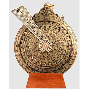
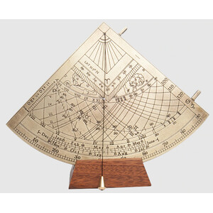
Reproduction of a navigational astrolabe made in 1571 for the naval forces of Philip II of Spain (1527-1598).
An original example of this astrolabe is carefully preserved in the National Maritime Museum (Greenwich).
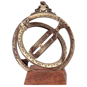
The navigational astrolabe was used to determine the geographical latitude of a ship at sea by measuring either the highest point of the sun at noon or the height of a star with a known declination.
In the early years of transoceanic shipping, it was not possible to determine the geographical longitude at sea. The geographical latitude, on the other hand, was easy to determine.
To reach a location whose geographical latitude was known, the ship sailed to that latitude and then east or west until the location was reached.
The navigational astrolabe was a simple brass ring engraved with degrees and a rotating angle indicator for aligning the sun or a star.
The ring was made of heavy cast brass so that it could not be caught by the wind.
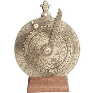
The navigational astrolabe was very popular in the late 15th and early 16th centuries.
It was a typical navigational instrument used by Christopher Columbus and Vasco da Gama.
The attention to detail, historical interest and beauty of the design are what make this mariner's astrolabe so special. It comes complete with a wooden base and instructions.